Architecture, Engineering and Construction
Map, Model, and Inspect with Drone Solutions, Automate Workflows, and Digitize Your Assets.
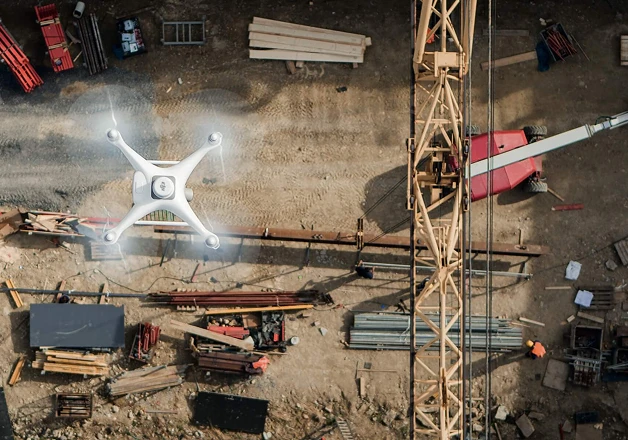
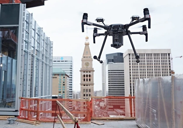
Professional Drone Services for Architecture, Engineering, and Construction
Map large work sites to acquire detailed, precise data using drones. 2D maps and 3D models help teams optimize project planning and designs. Drone solutions, along with image stitching and 3D modeling software help teams stay fully informed on site progress and resource allocation keeping projects on time and on track. Aerial data is the innovative solution to deliver sophisticated analytics or provide a visual progress report to stakeholders. Create 3D models with accurate positioning data that can be readily fitted into the BIM models to visualize designs. Designs can be optimized using drone-created 3D models that are compatible with a variety of GIS software.

Architecture, Engineering and Construction Solutions
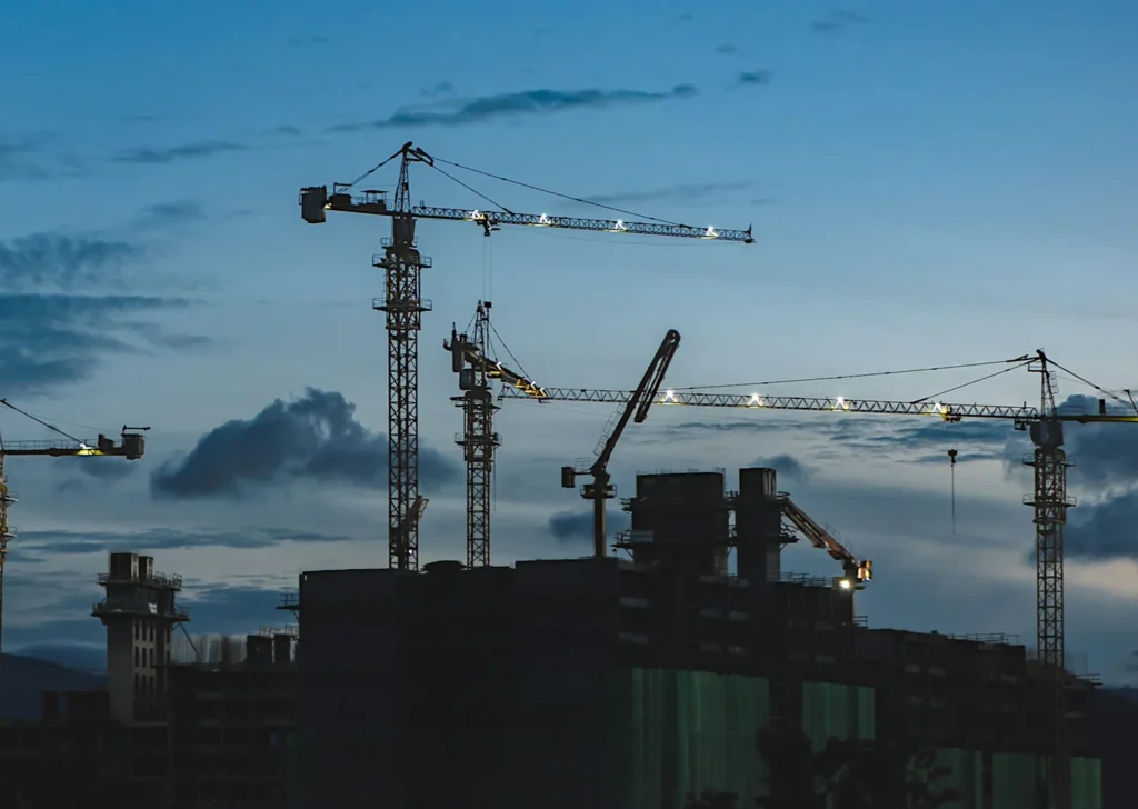
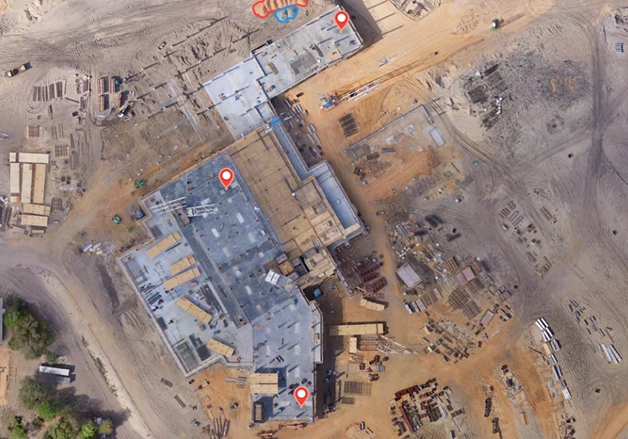
Construction Monitoring
Construction Monitoring
Drone solutions, along with image stitching and 3D modeling software help teams stay fully informed on site progress and resource allocation – keeping projects on time and on track. Provide complete site overviews and deliver accurate data on-demand, keeping personnel safe while improving efficiency throughout the project life cycle. Live stream footage back to the command center, enabling timely information delivery and coordinated decision making. Measurement data on earthwork and materials help accurately estimate workload and update project progress.
Contact UsConstruction Monitoring
Drone solutions, along with image stitching and 3D modeling software help teams stay fully informed on site progress and resource allocation – keeping projects on time and on track. Provide complete site overviews and deliver accurate data on-demand, keeping personnel safe while improving efficiency throughout the project life cycle. Live stream footage back to the command center, enabling timely information delivery and coordinated decision making. Measurement data on earthwork and materials help accurately estimate workload and update project progress.
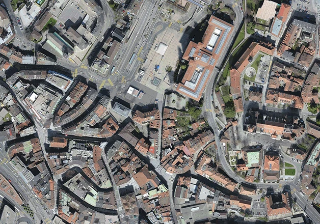
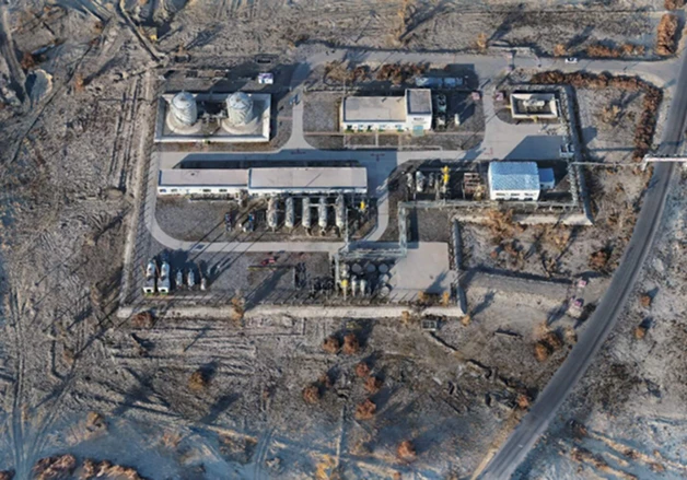
Orthomosaic Maps
Orthomosaic Maps
Build high-definition 2D maps of facilities using survey-grade drones, quickly. Get highly detailed, geometrically-accurate imaging representations of your worksite. Generate 1:500 scale maps without using GCPs while meeting centimeter-level accuracy requirements. Improve the efficiency of data collection and processing up to 10 times, acquiring deliverables quickly and shortening project lifecycles.
Contact UsOrthomosaic Maps
Build high-definition 2D maps of facilities using survey-grade drones, quickly. Get highly detailed, geometrically-accurate imaging representations of your worksite. Generate 1:500 scale maps without using GCPs while meeting centimeter-level accuracy requirements. Improve the efficiency of data collection and processing up to 10 times, acquiring deliverables quickly and shortening project lifecycles.
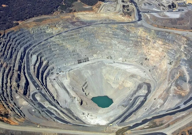
Stockpile Volumetrics
Stockpile Volumetrics
Obtain accurate volume measurements of stockpiles and construction aggregates using 3D models built with aerial images. Quickly deploy drones in hard-to-reach areas to collect high-resolution aerial images for point clouds and precise 3D models. Fly as regularly as needed and generate accurate models on demand, covering large sites in just a few days.
Contact UsStockpile Volumetrics
Obtain accurate volume measurements of stockpiles and construction aggregates using 3D models built with aerial images. Quickly deploy drones in hard-to-reach areas to collect high-resolution aerial images for point clouds and precise 3D models. Fly as regularly as needed and generate accurate models on demand, covering large sites in just a few days.
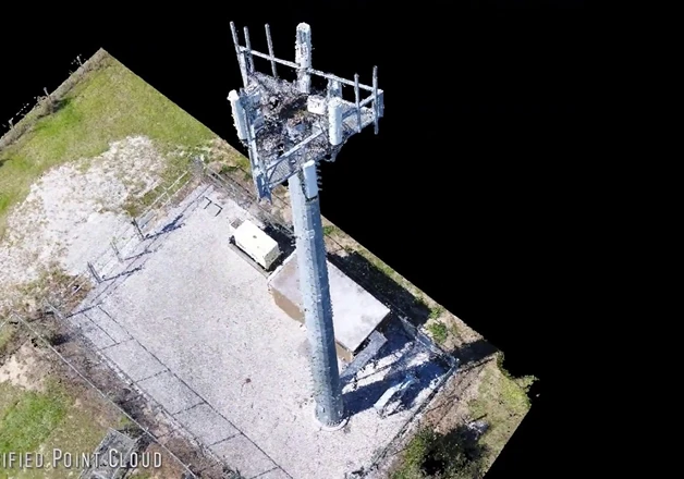
Asset Digitization
Asset Digitization
Build high-definition 2D maps and 3D models of facilities and vertical structures using survey-grade drones, illustrating inspection results digitally. Drones are portable and flexible, and can be operated in remote areas such as in the mountains or in forests. Drones are a lot more affordable than traditional surveying equipment, while being easier to operate and extract useful insights. Quickly build a detailed 3D model of a building to facilitate construction acceptance and routine inspection and maintenance.
Contact UsAsset Digitization
Build high-definition 2D maps and 3D models of facilities and vertical structures using survey-grade drones, illustrating inspection results digitally. Drones are portable and flexible, and can be operated in remote areas such as in the mountains or in forests. Drones are a lot more affordable than traditional surveying equipment, while being easier to operate and extract useful insights. Quickly build a detailed 3D model of a building to facilitate construction acceptance and routine inspection and maintenance.
Building Inspection and Maintenance
Building Inspection and Maintenance
Quickly map and model buildings to digitize the inspection and maintenance process, reducing costs while keeping personnel safe. Rapidly and remotely inspect, map, and monitor facilities such as flare stacks and cooling towers from the ground without stopping operations. Gain comprehensive overviews of the whole site, including all parts of high-rising structures, without risking the lives of personnel. Digitize inspection results for coordinated response, recordkeeping, and streamlined project management.
Contact UsBuilding Inspection and Maintenance
Quickly map and model buildings to digitize the inspection and maintenance process, reducing costs while keeping personnel safe. Rapidly and remotely inspect, map, and monitor facilities such as flare stacks and cooling towers from the ground without stopping operations. Gain comprehensive overviews of the whole site, including all parts of high-rising structures, without risking the lives of personnel. Digitize inspection results for coordinated response, recordkeeping, and streamlined project management.
Construction Planning
Construction Planning
Map large areas to acquire detailed, precise data using drones. Project teams can optimize designs based on accurate geographic coordinates. Quickly take off and fly over the worksite to create a 3D model of the area where a route might be planned. Create 3D models with accurate positioning data that can be readily fitted into the BIM models to visualize designs. Generate better route designs using 3D models that are compatible with a variety of GIS software.
Contact UsConstruction Planning
Map large areas to acquire detailed, precise data using drones. Project teams can optimize designs based on accurate geographic coordinates. Quickly take off and fly over the worksite to create a 3D model of the area where a route might be planned. Create 3D models with accurate positioning data that can be readily fitted into the BIM models to visualize designs. Generate better route designs using 3D models that are compatible with a variety of GIS software.

Site Survey
Site Survey
Map large areas to acquire detailed, precise data using drones. Project teams can rely on cost-effective drone solutions to efficiently visualize reality and collect surveying data needed to evaluate large worksites and optimize designs based on accurate geographic coordinates. Easily take off and fly over complex worksites to collect highly accurate data. Rapidly generate 2D orthomosaics and 3D models as references for engineering planning and design. Superimpose designs with 2D and 3D reconstructions to visualize the effect and make adjustments.
Contact UsSite Survey
Map large areas to acquire detailed, precise data using drones. Project teams can rely on cost-effective drone solutions to efficiently visualize reality and collect surveying data needed to evaluate large worksites and optimize designs based on accurate geographic coordinates. Easily take off and fly over complex worksites to collect highly accurate data. Rapidly generate 2D orthomosaics and 3D models as references for engineering planning and design. Superimpose designs with 2D and 3D reconstructions to visualize the effect and make adjustments.
As Built Condition
As Built Condition
Documenting on-site data throughout a project life cycle, contractors can easily track changes and build as-built models that reflect changes in detail before accepting the final project. Drones deliver complete inspection data on structures covering multiple angles without missing any details. Can be deployed quickly, saving time and labor while keeping personnel safe. Quickly build a detailed 3D model of a building to facilitate construction acceptance and routine inspection and maintenance.
Contact UsAs Built Condition
Documenting on-site data throughout a project life cycle, contractors can easily track changes and build as-built models that reflect changes in detail before accepting the final project. Drones deliver complete inspection data on structures covering multiple angles without missing any details. Can be deployed quickly, saving time and labor while keeping personnel safe. Quickly build a detailed 3D model of a building to facilitate construction acceptance and routine inspection and maintenance.
Have a question?
Why Aerial Data Solutions
Aerial Data Solutions has been trusted by hundreds of worksites across the country to provide mission critical data. We are focused on safety, standard of quality, and hassle-free operations with great customer service. Our vetted and trained pilots are available worldwide, insured, and compliant with regulations. As the world’s trusted Aerial Data Acquisition Service Provider, we will deliver ROI-positive results that are more cost-efficient than building an in-house drone program.