
Cemetery Management and Planning
Drones enable large-scale, detailed surveys of cemeteries, which allow for more accurate inventory maintenance, perpetual care, and preservation work.
Professional Services for Cemetery Management and Planning
Drones capture high-resolution images of complex structures for accurate 3D models, creating digital archives and streamlining maintenance. Drones can safely capture close-up photos of buildings to create detailed models. Digital copies of heritage sites assist in their identification, protection and preservation, as well as benefit industries such as tourism and education. Our 3D maps which integrate into industry standard GIS programs assist cemeteries in lot management, restoration and perpetual care. Assess ground conditions and inventory based on updated maps and collect valuable insights on the condition of monuments and various historic assets quickly.

Cemetery Management Solutions
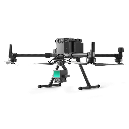
Aerial LIDAR Scanning
Aerial LIDAR Scanning
Using Drones with the latest in LIDAR Scanning technology Digital Twins can be produced of historic buildings allowing for inspection and measurements to be made to assist in the restoration and preservation process
Contact UsAerial LIDAR Scanning
Using Drones with the latest in LIDAR Scanning technology Digital Twins can be produced of historic buildings allowing for inspection and measurements to be made to assist in the restoration and preservation process

Ground Based LIDAR Scanning
Ground Based LIDAR Scanning
Safely inspect and map the interiors of monuments and cultural sites to get a digital replica of the building to properly catalog the contents of the building while also allowing for measurements to be made for the restoration process.
Contact UsGround Based LIDAR Scanning
Safely inspect and map the interiors of monuments and cultural sites to get a digital replica of the building to properly catalog the contents of the building while also allowing for measurements to be made for the restoration process.

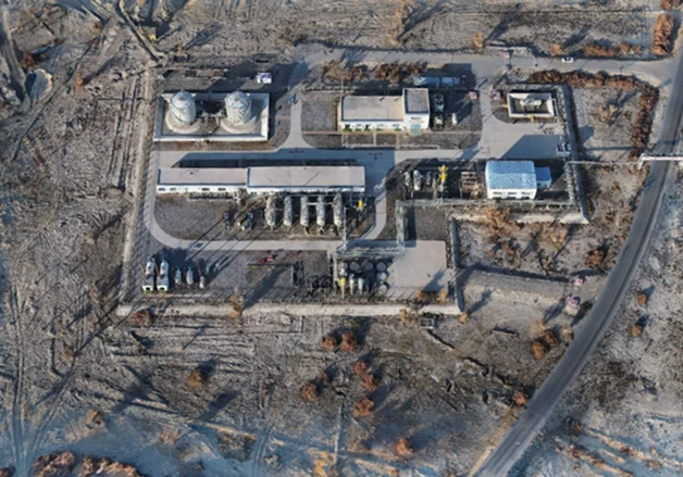
Site Surveying
Site Surveying
Quickly and accurately survey historic sites allowing for on demand site documentation. Generate 1:500 scale maps without using GCPs while meeting centimeter-level accuracy requirements. Gain industry-standard outputs like DOM, DSM, 3D reality models and more.
Contact UsSite Surveying
Quickly and accurately survey historic sites allowing for on demand site documentation. Generate 1:500 scale maps without using GCPs while meeting centimeter-level accuracy requirements. Gain industry-standard outputs like DOM, DSM, 3D reality models and more.
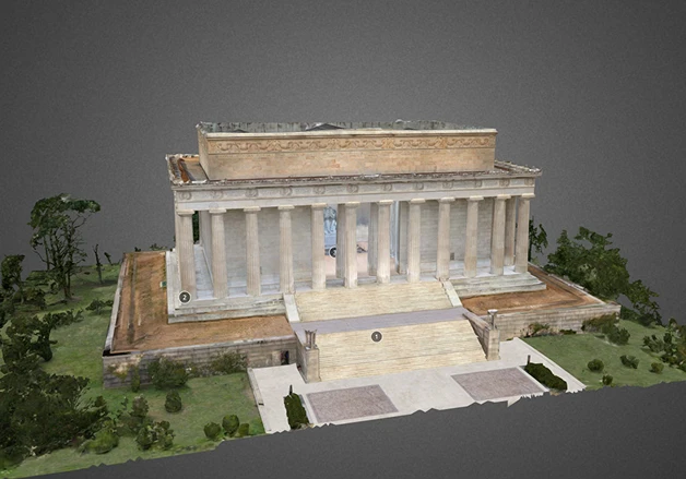
3D Models
3D Models
Quickly map and model buildings, capture high-resolution images of complex structures for accurate 3D models, creating digital archives and streamlining maintenance. These 3D models can be used for preservation and education.
Contact Us3D Models
Quickly map and model buildings, capture high-resolution images of complex structures for accurate 3D models, creating digital archives and streamlining maintenance. These 3D models can be used for preservation and education.
3D Maps
3D Maps
Quickly and accurately map and model the heritage site allowing for artifact location to be recorded or virtual site visits to happen allowing teams to collaborate on site preservation without being on the site. 3D maps also allow for education uses such as virtual tours.
Contact Us3D Maps
Quickly and accurately map and model the heritage site allowing for artifact location to be recorded or virtual site visits to happen allowing teams to collaborate on site preservation without being on the site. 3D maps also allow for education uses such as virtual tours.
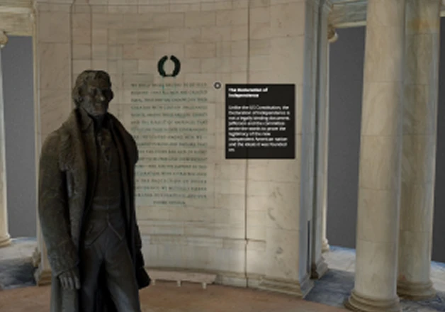
Virtual Tours
Virtual Tours
Turn the 3D maps and Models into virtual tours for the heritage sites allowing students and visitors to view the artifacts and sites from any where in the world. Guided tours can take place online on demand simulating being at the heritage site.
Contact UsVirtual Tours
Turn the 3D maps and Models into virtual tours for the heritage sites allowing students and visitors to view the artifacts and sites from any where in the world. Guided tours can take place online on demand simulating being at the heritage site.
Have a question?
Why Aerial Data Solutions
Aerial Data Solutions has been trusted by hundreds of worksites across the country to provide mission critical data. We are focused on safety, standard of quality, and hassle-free operations with great customer service. Our vetted and trained pilots are available worldwide, insured, and compliant with regulations. As the world’s trusted Aerial Data Acquisition Service Provider, we will deliver ROI-positive results that are more cost-efficient than building an in-house drone program.