
Commercial and Residential Real Estate
Receive actionable information from the sky for better, real-time decisions across residential, commercial, industrial, and other assets.
Professional Services for Commercial and Residential Real Estate
Drone flights provide reliable, high-quality aerial data of commercial, residential, and industrial properties as well as other critical assets and infrastructure empowering Property Management companies to make faster, better decisions. We create high-resolution aerial images, video, maps and 3d models all across the country for properties and work sites of all types. Drone inspections equip property managers with the necessary insights they need to identify a potential issue and take preventive action to avoid a hefty repair bill.

Commercial and Residential Real Estate Aerial Inspection Solutions
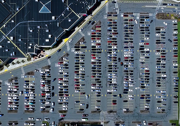
Parking Lot Inspections
Parking Lot Inspections
Drones can obtain imagery on pavement conditions so you can find stress cracks and wear faster than ever.
Contact UsParking Lot Inspections
Drones can obtain imagery on pavement conditions so you can find stress cracks and wear faster than ever.
Roof & Equipment Inspections
Roof & Equipment Inspections
Safely inspect hard to access areas with standard or thermal imagery to evaluate roof conditions, water damage, and more.
Contact UsRoof & Equipment Inspections
Safely inspect hard to access areas with standard or thermal imagery to evaluate roof conditions, water damage, and more.
Marketing Material
Marketing Material
Illustrate proximity to nearby roads and other features with a bird’s-eye view and angles only a drone can capture.
Contact UsMarketing Material
Illustrate proximity to nearby roads and other features with a bird’s-eye view and angles only a drone can capture.
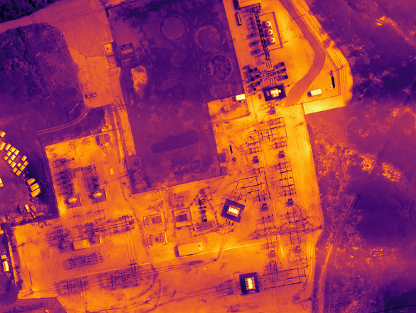
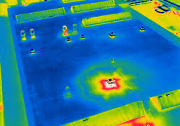
Thermal Inspections
Thermal Inspections
Using State of the Art FLIR Thermal Imagery find leaks in your roof and optimize your insulation to save money on heating and cooling cost
Contact UsThermal Inspections
Using State of the Art FLIR Thermal Imagery find leaks in your roof and optimize your insulation to save money on heating and cooling cost
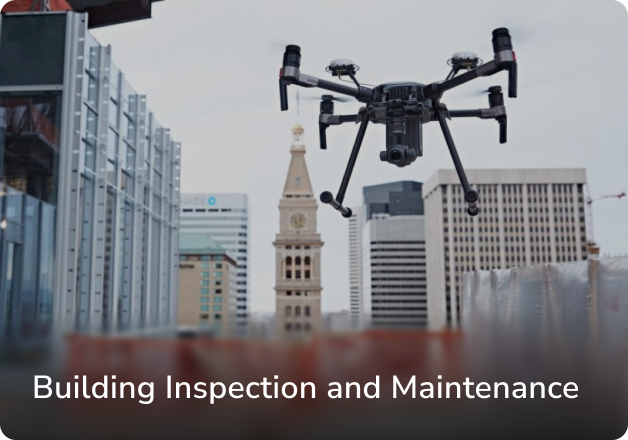
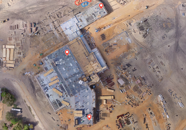
Building Inspection and Maintenance
Building Inspection and Maintenance
Quickly map and model buildings to digitize the inspection and maintenance process, reducing costs while keeping personnel safe.
Contact UsBuilding Inspection and Maintenance
Quickly map and model buildings to digitize the inspection and maintenance process, reducing costs while keeping personnel safe.
HVAC & Equipment Inspections
HVAC & Equipment Inspections
Inspect HVAC and other mission critical roof mounted equipment to ensure optimal performance without putting employees in harms way and without downtime
Contact UsHVAC & Equipment Inspections
Inspect HVAC and other mission critical roof mounted equipment to ensure optimal performance without putting employees in harms way and without downtime
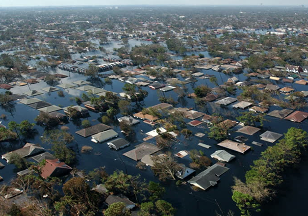
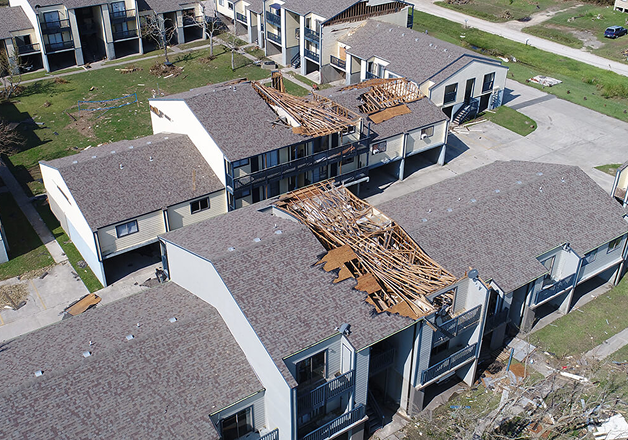
Natural Disaster Claims
Natural Disaster Claims
Map and photograph large areas to acquire detailed, precise data using drones. Capturing accurate aerial data of your property after a natural disaster
Contact UsNatural Disaster Claims
Map and photograph large areas to acquire detailed, precise data using drones. Capturing accurate aerial data of your property after a natural disaster
Commercial Underwriting
Commercial Underwriting
Know with confidence that existing damage or issues will not be your problem.
Contact UsCommercial Underwriting
Know with confidence that existing damage or issues will not be your problem.
Insurance Inspections
Insurance Inspections
Capture previously unavailable insights with unbeatable speed.
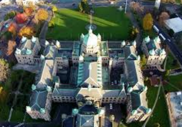
Aerial Video & Photography
Aerial Video & Photography
Stunning aerial footage including images, video, and panoramas to showcase your residential property from a unique perspective in the sky
Contact UsAerial Video & Photography
Stunning aerial footage including images, video, and panoramas to showcase your residential property from a unique perspective in the sky

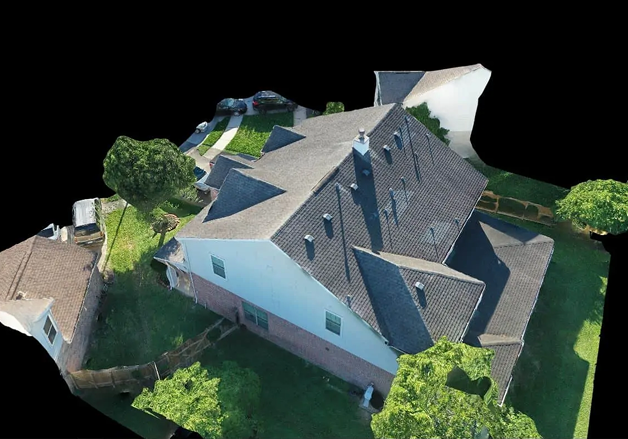
3D Models
3D Models
Build high-definition 2D maps and 3D models of facilities and vertical structures using survey-grade drones, illustrating inspection results digitally
Contact Us3D Models
Build high-definition 2D maps and 3D models of facilities and vertical structures using survey-grade drones, illustrating inspection results digitally
Virtual Tours
Virtual Tours
Build high-definition 3D models of facilities, properties and assets to allow clients to view the assets in 3D as if they were on site
Contact UsVirtual Tours
Build high-definition 3D models of facilities, properties and assets to allow clients to view the assets in 3D as if they were on site
Have a question?
Why Aerial Data Solutions
Aerial Data Solutions has been trusted by hundreds of worksites across the country to provide mission critical data. We are focused on safety, standard of quality, and hassle-free operations with great customer service. Our vetted and trained pilots are available worldwide, insured, and compliant with regulations. As the world’s trusted Aerial Data Acquisition Service Provider, we will deliver ROI-positive results that are more cost-efficient than building an in-house drone program.